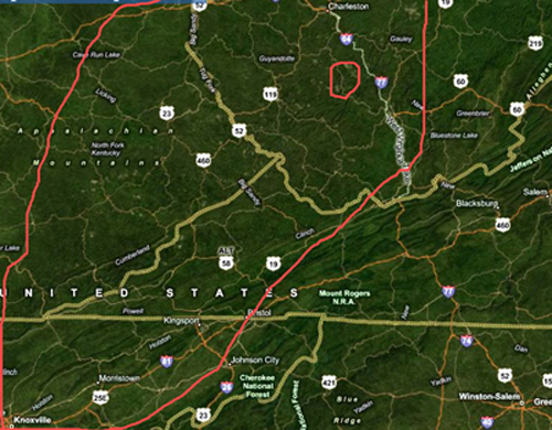
| On November 1st I had my first opportunity to view mountain top removal mining from the air thanks to a flight that was provided to me by SouthWings. While I was not surprised by the devastation, I was surprised by the magnitude of the mining and the total number of mines that we saw on our short flight. The accompanying map is a very rough representation of where mining is taking place and helps put things into perspective. The large red line on the map represents the approximate areas in the southern Appalachians where MTR is taking place. The small red circle is the area where the 73 images in this gallery were made on my flight. We have to ask ourselves if there was this much devastation in such a small area, then how much damage has been done to the ecosystem throughout the rest of coal country? I dread the thought of another twenty years of mountain top removal being allowed to happen. The time to act is now. |